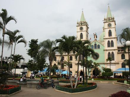
Besighede in Samborondón
Industries
Besigheidsverspreiding volgens industrie Inkopies: 19,5%
Restaurante: 18,7%
Voedsel: 8,1%
Tuisdienste: 8,1%
Professionele Dienste: 5,9%
Opvoeding: 5,1%
Ander: 34,5%
| Bedryfsbeskrywing | Aantal inrigtings | Gemiddelde Google-gradering | Besighede per 1 000 inwoners |
|---|---|---|---|
| Haarkappers | 12 | 4.5 | 1.3 |
| Skoonheidssalonne | 13 | 4.4 | 1.4 |
| Sekondêre onderrig | 14 | 4.3 | 1.5 |
| Banke | 15 | 4.0 | 1.6 |
| Leningsmaatskappye | 12 | 4.0 | 1.3 |
| Bakkerye | 17 | 4.1 | 1.8 |
| Kruidenierswinkels en supermarkte | 16 | 4.1 | 1.7 |
| Bou van huise | 41 | 4.3 | 4.3 |
| Eiendom | 24 | 4.4 | 2.5 |
| Ander akkomodasie | 12 | 4.4 | 1.3 |
| Hospitale | 11 | 3.8 | 1.2 |
| Amerikaanse restaurante | 14 | 4.5 | 1.5 |
| Dansklubs en diskoteke | 10 | 4.7 | 1.0 |
| Italiaanse restaurante | 11 | 4.3 | 1.2 |
| Kafees | 22 | 4.4 | 2.3 |
| Kroeë en tavernes | 19 | 4.5 | 2.0 |
| Latyns Amerikaanse restaurante | 13 | 4.5 | 1.4 |
| Meksikaanse restaurante | 10 | 4.4 | 1.0 |
| Afdelingswinkels | 24 | 4.5 | 2.5 |
| Apteke | 12 | 4.4 | 1.3 |
| Huishoudelike toebehore en goedere | 12 | 4.2 | 1.3 |
| Kantoorvoorrade en skryfbehoeftewinkels | 22 | 3.3 | 2.3 |
| Klerewinkels | 12 | 4.4 | 1.3 |
| Fiksheidssentrums | 14 | 4.6 | 1.5 |
| Oppervlak van Samborondón, Provincia del Guayas | 131,5 km² |
| Bevolking | 9544 |
| Manlike bevolking | 4674 (49%) |
| Vroulike bevolking | 4870 (51%) |
| Bevolkingsverandering vanaf 1975 tot 2015 | +72,5% |
| Bevolkingsverandering vanaf 2000 tot 2015 | +18,8% |
| Gemiddelde ouderdom | 28,1 |
| Gemiddelde ouderdom van mans | 27,6 |
| Gemiddelde Ouderdom, Vrouens | 28,6 |
| Area Kodes | 4 |
| Woongebiede | Ciudad Celeste, Ciudadela Entre Rios, La Aurora, Los Arcos, Lotizacion Xandu, Palestina, Parque Del Rio |
| Lokaaltyd | Donderdag 18:06 |
| Tydsone | Ecuador-tyd |
| Lengte & Breedtegraad | -1.96276° / -79.72402° |
| Poskodes | 091650, 092304 |
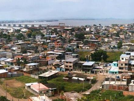
Kaart - Samborondón, Provincia del Guayas
Bevolking Samborondón, Provincia del Guayas
Jaar 1975 tot 2015| data | 1975 | 1990 | 2000 | 2015 |
|---|---|---|---|---|
| Bevolking | 5534 | 8119 | 8034 | 9544 |
| Bevolkingsdigtheid | 42.1 / km² | 61.7 / km² | 61.1 / km² | 72.6 / km² |
Bevolkingswisseling vanaf 2000 tot 2015 Samborondón
Verhoging van18,8% vanaf jaar2000 tot 2015| Plek | Verandering sedert 1975 | Verandering sedert 1990 | Verandering sedert 2000 |
|---|---|---|---|
| Samborondón, Provincia del Guayas | +72,5% | +17,6% | +18,8% |
| Guayas | +130,3% | +57% | +27% |
| Ecuador | +131,1% | +58,1% | +27,9% |
Gemiddelde ouderdom Samborondón, Provincia del Guayas
Gemiddelde ouderdom: 28,1 jaar| Plek | Gemiddelde ouderdom | Mediaan ouderdom (vroulik) | Mediaan ouderdom (manlik) |
|---|---|---|---|
| Samborondón, Provincia del Guayas | 28,1 jaar | 28,6 jaar | 27,6 jaar |
| Guayas | 26,2 jaar | 26,5 jaar | 25,8 jaar |
| Ecuador | 25,1 jaar | 25,6 jaar | 24,5 jaar |
Samborondón, Provincia del Guayas Bevolkingsboom
Bevolking volgens ouderdom en geslag| ouderdom | Manlik | Vroulik | totale |
|---|---|---|---|
| Onder 5 | 425 | 416 | 842 |
| 5-9 | 452 | 440 | 893 |
| 10-14 | 475 | 440 | 916 |
| 15-19 | 427 | 440 | 868 |
| 20-24 | 381 | 417 | 799 |
| 25-29 | 334 | 387 | 722 |
| 30-34 | 346 | 379 | 725 |
| 35-39 | 334 | 376 | 711 |
| 40-44 | 290 | 327 | 617 |
| 45-49 | 276 | 306 | 582 |
| 50-54 | 248 | 242 | 490 |
| 55-59 | 212 | 216 | 429 |
| 60-64 | 166 | 153 | 319 |
| 65-69 | 124 | 115 | 239 |
| 70-74 | 75 | 70 | 146 |
| 75-79 | 47 | 56 | 103 |
| 80-84 | 34 | 46 | 81 |
| 85 Plus | 28 | 46 | 74 |
Bevolkingsdigtheid Samborondón, Provincia del Guayas
Bevolkingsdigtheid: 72.6 / km²| Plek | Bevolking | gebied | Bevolkingsdigtheid |
|---|---|---|---|
| Samborondón, Provincia del Guayas | 9544 | 131,5 km² | 72.6 / km² |
| Guayas | 4.0 miljoen | 15 835,7 km² | 252.0 / km² |
| Ecuador | 15.8 miljoen | 256 053,3 km² | 61.9 / km² |
Geskiedkundige en Geprojekteerde Bevolking Samborondón, Provincia del Guayas
Geskatte bevolking vanaf 900 tot 2100Sources:
1. JRC (European Commission's Joint Research Centre) work on the GHS built-up grid
2. CIESIN (Center for International Earth Science Information Network)
3. [skakel] Klein Goldewijk, K., Beusen, A., Doelman, J., and Stehfest, E.: Anthropogenic land use estimates for the Holocene – HYDE 3.2, Earth Syst. Sci. Data, 9, 927–953, https://doi.org/10.5194/essd-9-927-2017, 2017.
Woongebiede
Verspreiding van besighede volgens buurt in Samborondón Los Arcos: 18,6%
La Aurora: 12,8%
Palestina: 11%
Ander: 57,6%
Besigheidsverspreiding per prys vir Samborondón, Provincia del Guayas
matige: 41,6%
goedkoop: 40,9%
duur: 15,4%
Baie Duur: 2%
Menslike Ontwikkelingsindeks (HDI)
Statistiese saamgestelde indeks van lewensverwagting, opvoeding en per capita-inkomste.Sources: [Link] Kummu, M., Taka, M. & Guillaume, J. Gridded global datasets for Gross Domestic Product and Human Development Index over 1990–2015. Sci Data 5, 180004 (2018) doi:10.1038/sdata.2018.4
CO2-emissies Samborondón, Provincia del Guayas
Koolstofdioksied (CO2) -uitlatings per capita per ton per jaar| Plek | CO2-emissies | CO2-emissies per capita | CO2-emissiesintensiteit |
|---|---|---|---|
| Samborondón, Provincia del Guayas | 31 762 VSA-t. | 3,33 VSA-t. | 241,5 VSA-ton/km² |
| Guayas | 12 787 308 VSA-t. | 3,2 VSA-t. | 807,5 VSA-ton/km² |
| Ecuador | 43 886 499 VSA-t. | 2,77 VSA-t. | 171,4 VSA-ton/km² |
CO2-emissies Samborondón, Provincia del Guayas
| CO2-emissies (metrieke ton/jaar) 2013 | 31 762 VSA-t. |
| 2013 CO2-emissies (metrieke ton/jaar) per capita | 3,33 VSA-t. |
| 2013 CO2 uitlaat-intensiteit (tonnes/km²/year) | 241,5 VSA-ton/km² |
Natuurlike gevare risiko
Relatiewe risiko uit 10| droogte | Hoog (8) |
| vloed | Hoog (9) |
| aardbewing | Hoog (7) |
* Risiko's, veral met betrekking tot oorstromings of grondverskuiwings, is moontlik nie vir die hele gebied nie.
Sources: 1. Dilley, M., R.S. Chen, U. Deichmann, A.L. Lerner-Lam, M. Arnold, J. Agwe, P. Buys, O. Kjekstad, B. Lyon, and G. Yetman. 2005. Natural Disaster Hotspots: A Global Risk Analysis. Washington, D.C.: World Bank. https://doi.org/10.1596/0-8213-5930-4.
2. Center for Hazards and Risk Research - CHRR - Columbia University, Center for International Earth Science Information Network - CIESIN - Columbia University, and International Research Institute for Climate and Society - IRI - Columbia University. 2005. Global Drought Hazard Frequency and Distribution. Palisades, NY: NASA Socioeconomic Data and Applications Center (SEDAC). https://doi.org/10.7927/H4VX0DFT.
3. Center for Hazards and Risk Research - CHRR - Columbia University, Center for International Earth Science Information Network - CIESIN - Columbia University. 2005. Global Earthquake Hazard Distribution - Peak Ground Acceleration. Palisades, NY: NASA Socioeconomic Data and Applications Center (SEDAC). https://doi.org/10.7927/H4BZ63ZS.
4. Center for Hazards and Risk Research - CHRR - Columbia University, Center for International Earth Science Information Network - CIESIN - Columbia University. 2005. Global Flood Hazard Frequency and Distribution. Palisades, NY: NASA Socioeconomic Data and Applications Center (SEDAC). https://doi.org/10.7927/H4668B3D.
Onlangse aardbewings in die omgewing
Grootte 3.0 en groter| Datum | Tyd | grootte | Afstand | diepte | Plek | skakel |
|---|---|---|---|---|---|---|
| 2019-02-22 | 02:40 | 5,5 | 30,4 km | 70 890 m | 11km ESE of Duran, Ecuador | usgs.gov |
| 2018-10-21 | 14:08 | 5,1 | 20,6 km | 68 880 m | 13km NE of El Triunfo, Ecuador | usgs.gov |
| 2018-06-15 | 06:35 | 4,4 | 10,8 km | 98 040 m | 12km NNE of Yaguachi, Ecuador | usgs.gov |
| 2018-04-15 | 20:03 | 3,8 | 45,9 km | 10 000 m | 5km S of Montalvo, Ecuador | usgs.gov |
| 2017-11-27 | 18:04 | 5 | 29,8 km | 70 020 m | 13km NNE of Santa Lucia, Ecuador | usgs.gov |
| 2017-11-05 | 22:06 | 4,1 | 23,1 km | 105 470 m | 3km S of Alfredo Baquerizo Moreno, Ecuador | usgs.gov |
| 2017-02-18 | 22:26 | 3,5 | 38,4 km | 70 460 m | 8km SSW of Guayaquil, Ecuador | usgs.gov |
| 2016-11-19 | 11:55 | 4,4 | 10,5 km | 76 840 m | 11km SSW of Samborondon, Ecuador | usgs.gov |
| 2016-10-28 | 00:33 | 3,6 | 15 km | 67 410 m | 15km NNE of Guayaquil, Ecuador | usgs.gov |
| 2016-09-21 | 17:53 | 4,3 | 48,3 km | 80 140 m | 20km S of Duran, Ecuador | usgs.gov |
Vind historiese aardbewings wat voorgekom het naby Samborondón, Provincia del Guayas
Vroegste datum Laaste datum
Grootte 3.0 en groter Grootte 4.0 en groter Grootte 5.0 en groter
Poskodes
Persentasie besighede per Poskodes in Samborondón Poskode 092301: 89,4%
Poskode 092302: 5%
Ander: 5,6%
Oor ons data
Die gegewens op hierdie bladsy word geskat met behulp van 'n aantal gereedskap en bronne wat in die openbaar beskikbaar is. Dit word voorsien sonder waarborg, en dit kan onakkuraathede bevat. Gebruik dit op eie risiko. Kyk hier vir meer inligting.