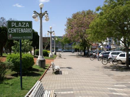
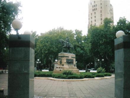
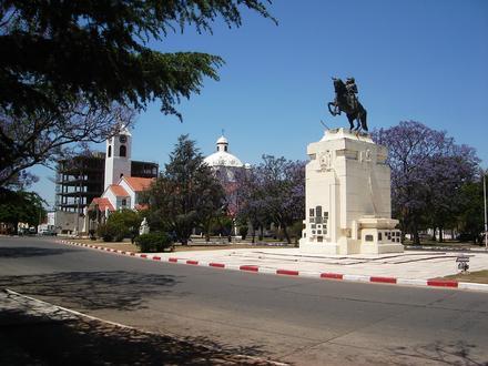
Besighede in Coronel Baigorria
| Oppervlak van Coronel Baigorria, Provincia de Córdoba | 0,763 km² |
| Bevolking | 1207 |
| Bevolkingsverandering vanaf 1975 tot 2015 | +427,1% |
| Bevolkingsverandering vanaf 2000 tot 2015 | +22,9% |
| Area Kodes | 2362, 358 |
| Lokaaltyd | Sondag 01:23 |
| Tydsone | Argentinië-standaardtyd |
| Lengte & Breedtegraad | -32.8477° / -64.36107° |
Kaart - Coronel Baigorria, Provincia de Córdoba
Bevolking Coronel Baigorria, Provincia de Córdoba
Jaar 1975 tot 2015| data | 1975 | 1990 | 2000 | 2015 |
|---|---|---|---|---|
| Bevolking | 229 | 886 | 982 | 1207 |
| Bevolkingsdigtheid | 300.0 / km² | 1160 / km² | 1286 / km² | 1580 / km² |
Bevolkingswisseling vanaf 2000 tot 2015 Coronel Baigorria
Verhoging van22,9% vanaf jaar2000 tot 2015| Plek | Verandering sedert 1975 | Verandering sedert 1990 | Verandering sedert 2000 |
|---|---|---|---|
| Coronel Baigorria, Provincia de Córdoba | +427,1% | +36,2% | +22,9% |
| Córdoba | +51% | +24% | +12,2% |
| Argentinië | +66,4% | +32,6% | +17,1% |
Bevolkingsdigtheid Coronel Baigorria, Provincia de Córdoba
Bevolkingsdigtheid: 1580 / km²| Plek | Bevolking | gebied | Bevolkingsdigtheid |
|---|---|---|---|
| Coronel Baigorria, Provincia de Córdoba | 1207 | 0,763 km² | 1580 / km² |
| Córdoba | 3.5 miljoen | 164 773,3 km² | 21.4 / km² |
| Argentinië | 43.2 miljoen | 2 779 516,9 km² | 15.5 / km² |
Geskiedkundige en Geprojekteerde Bevolking Coronel Baigorria, Provincia de Córdoba
Geskatte bevolking vanaf 1870 tot 2100Sources:
1. JRC (European Commission's Joint Research Centre) work on the GHS built-up grid
2. CIESIN (Center for International Earth Science Information Network)
3. [skakel] Klein Goldewijk, K., Beusen, A., Doelman, J., and Stehfest, E.: Anthropogenic land use estimates for the Holocene – HYDE 3.2, Earth Syst. Sci. Data, 9, 927–953, https://doi.org/10.5194/essd-9-927-2017, 2017.
Menslike Ontwikkelingsindeks (HDI)
Statistiese saamgestelde indeks van lewensverwagting, opvoeding en per capita-inkomste.Sources: [Link] Kummu, M., Taka, M. & Guillaume, J. Gridded global datasets for Gross Domestic Product and Human Development Index over 1990–2015. Sci Data 5, 180004 (2018) doi:10.1038/sdata.2018.4
CO2-emissies Coronel Baigorria, Provincia de Córdoba
Koolstofdioksied (CO2) -uitlatings per capita per ton per jaar| Plek | CO2-emissies | CO2-emissies per capita | CO2-emissiesintensiteit |
|---|---|---|---|
| Coronel Baigorria, Provincia de Córdoba | 6 142 VSA-t. | 5,09 VSA-t. | 8 045 VSA-ton/km² |
| Córdoba | 16 457 250 VSA-t. | 4,67 VSA-t. | 99,9 VSA-ton/km² |
| Argentinië | 198 107 944 VSA-t. | 4,59 VSA-t. | 71,3 VSA-ton/km² |
CO2-emissies Coronel Baigorria, Provincia de Córdoba
| CO2-emissies (metrieke ton/jaar) 2013 | 6 142 VSA-t. |
| 2013 CO2-emissies (metrieke ton/jaar) per capita | 5,09 VSA-t. |
| 2013 CO2 uitlaat-intensiteit (tonnes/km²/year) | 8 045 VSA-ton/km² |
Natuurlike gevare risiko
Relatiewe risiko uit 10| droogte | Medium (5) |
| vloed | Medium (4) |
| aardbewing | Laag (2) |
* Risiko's, veral met betrekking tot oorstromings of grondverskuiwings, is moontlik nie vir die hele gebied nie.
Sources: 1. Dilley, M., R.S. Chen, U. Deichmann, A.L. Lerner-Lam, M. Arnold, J. Agwe, P. Buys, O. Kjekstad, B. Lyon, and G. Yetman. 2005. Natural Disaster Hotspots: A Global Risk Analysis. Washington, D.C.: World Bank. https://doi.org/10.1596/0-8213-5930-4.
2. Center for Hazards and Risk Research - CHRR - Columbia University, Center for International Earth Science Information Network - CIESIN - Columbia University, and International Research Institute for Climate and Society - IRI - Columbia University. 2005. Global Drought Hazard Frequency and Distribution. Palisades, NY: NASA Socioeconomic Data and Applications Center (SEDAC). https://doi.org/10.7927/H4VX0DFT.
3. Center for Hazards and Risk Research - CHRR - Columbia University, Center for International Earth Science Information Network - CIESIN - Columbia University. 2005. Global Earthquake Hazard Distribution - Peak Ground Acceleration. Palisades, NY: NASA Socioeconomic Data and Applications Center (SEDAC). https://doi.org/10.7927/H4BZ63ZS.
4. Center for Hazards and Risk Research - CHRR - Columbia University, Center for International Earth Science Information Network - CIESIN - Columbia University. 2005. Global Flood Hazard Frequency and Distribution. Palisades, NY: NASA Socioeconomic Data and Applications Center (SEDAC). https://doi.org/10.7927/H4668B3D.
Onlangse aardbewings in die omgewing
Grootte 3.0 en groter| Datum | Tyd | grootte | Afstand | diepte | Plek | skakel |
|---|---|---|---|---|---|---|
| 2018-04-18 | 08:29 | 3,9 | 85,4 km | 10 000 m | 4km NNE of Merlo, Argentina | usgs.gov |
| 2011-11-07 | 09:51 | 4,7 | 64,7 km | 40 100 m | Cordoba, Argentina | usgs.gov |
| 2011-01-19 | 02:52 | 3,6 | 81,1 km | 12 300 m | Cordoba, Argentina | usgs.gov |
| 2003-03-05 | 07:22 | 4,1 | 73 km | 33 000 m | Cordoba, Argentina | usgs.gov |
| 1987-03-24 | 18:43 | 4,5 | 17,9 km | 29 800 m | Cordoba, Argentina | usgs.gov |
| 1975-01-27 | 22:32 | 4,1 | 29,8 km | 33 000 m | Cordoba, Argentina | usgs.gov |

Oor ons data
Die gegewens op hierdie bladsy word geskat met behulp van 'n aantal gereedskap en bronne wat in die openbaar beskikbaar is. Dit word voorsien sonder waarborg, en dit kan onakkuraathede bevat. Gebruik dit op eie risiko. Kyk hier vir meer inligting.