- Wêreld
- »
- US
- »
- Nebraska
- »
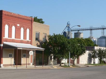
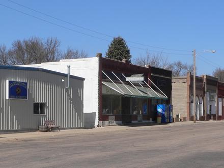
- Reynolds, Nebraska
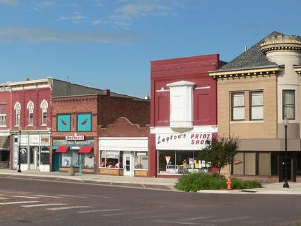
Besighede in Reynolds
| Oppervlak van Reynolds, Nebraska | 0,251 myl² |
| Bevolking | 54 |
| Bevolkingsverandering vanaf 1975 tot 2015 | +42,1% |
| Bevolkingsverandering vanaf 2000 tot 2015 | -15,6% |
| Area Kodes | 402 |
| Lokaaltyd | Dinsdag 01:13 |
| Tydsone | Noord-Amerikaanse sentrale dagligtyd |
| Lengte & Breedtegraad | 40.05973° / -97.33559° |
| Poskodes | 68429 |
Kaart - Reynolds, Nebraska
Bevolking Reynolds, Nebraska
Jaar 1975 tot 2015| data | 1975 | 1990 | 2000 | 2015 |
|---|---|---|---|---|
| Bevolking | 38 | 51 | 64 | 54 |
| Bevolkingsdigtheid | 151.4 / mi² | 203.2 / mi² | 255.0 / mi² | 215.2 / mi² |
Bevolkingswisseling vanaf 2000 tot 2015 Reynolds
Vermindering van 15,6% van jaar 2000 tot 2015| Plek | Verandering sedert 1975 | Verandering sedert 1990 | Verandering sedert 2000 |
|---|---|---|---|
| Reynolds, Nebraska | +42,1% | +5,9% | -15,6% |
| Nebraska | +32,9% | +19% | +8,9% |
| Verenigde State van Amerika | +46,9% | +27,2% | +13,7% |
Bevolkingsdigtheid Reynolds, Nebraska
Bevolkingsdigtheid: 215.2 / mi²| Plek | Bevolking | gebied | Bevolkingsdigtheid |
|---|---|---|---|
| Reynolds, Nebraska | 54 | 0,251 myl² | 215.2 / mi² |
| Nebraska | 1.9 miljoen | 77 347,8 myl² | 24.2 / mi² |
| Verenigde State van Amerika | 321.6 miljoen | 3 796 761,2 myl² | 84.7 / mi² |
Menslike Ontwikkelingsindeks (HDI)
Statistiese saamgestelde indeks van lewensverwagting, opvoeding en per capita-inkomste.Sources: [Link] Kummu, M., Taka, M. & Guillaume, J. Gridded global datasets for Gross Domestic Product and Human Development Index over 1990–2015. Sci Data 5, 180004 (2018) doi:10.1038/sdata.2018.4
CO2-emissies Reynolds, Nebraska
Koolstofdioksied (CO2) -uitlatings per capita per ton per jaar| Plek | CO2-emissies | CO2-emissies per capita | CO2-emissiesintensiteit |
|---|---|---|---|
| Reynolds, Nebraska | 1 113 VSA-t. | 20,6 VSA-t. | 4 437 VSA-ton/mi² |
| Nebraska | 38 508 417 VSA-t. | 20,5 VSA-t. | 497,9 VSA-ton/mi² |
| Verenigde State van Amerika | 5 664 619 809 VSA-t. | 17,6 VSA-t. | 1 491 VSA-ton/mi² |
CO2-emissies Reynolds, Nebraska
| CO2-emissies (metrieke ton/jaar) 2013 | 1 113 VSA-t. |
| 2013 CO2-emissies (metrieke ton/jaar) per capita | 20,6 VSA-t. |
| CO2-emissie-intensiteit 2013 |
Natuurlike gevare risiko
Relatiewe risiko uit 10| droogte | Medium (4) |
| vloed | Hoog (7) |
* Risiko's, veral met betrekking tot oorstromings of grondverskuiwings, is moontlik nie vir die hele gebied nie.
Sources: 1. Dilley, M., R.S. Chen, U. Deichmann, A.L. Lerner-Lam, M. Arnold, J. Agwe, P. Buys, O. Kjekstad, B. Lyon, and G. Yetman. 2005. Natural Disaster Hotspots: A Global Risk Analysis. Washington, D.C.: World Bank. https://doi.org/10.1596/0-8213-5930-4.
2. Center for Hazards and Risk Research - CHRR - Columbia University, Center for International Earth Science Information Network - CIESIN - Columbia University, and International Research Institute for Climate and Society - IRI - Columbia University. 2005. Global Drought Hazard Frequency and Distribution. Palisades, NY: NASA Socioeconomic Data and Applications Center (SEDAC). https://doi.org/10.7927/H4VX0DFT.
3. Center for Hazards and Risk Research - CHRR - Columbia University, Center for International Earth Science Information Network - CIESIN - Columbia University. 2005. Global Flood Hazard Frequency and Distribution. Palisades, NY: NASA Socioeconomic Data and Applications Center (SEDAC). https://doi.org/10.7927/H4668B3D.
Onlangse aardbewings in die omgewing
Grootte 3.0 en groter| Datum | Tyd | grootte | Afstand | diepte | Plek | skakel |
|---|---|---|---|---|---|---|
| 2017-06-13 | 02:40 | 3,6 | 78,7 km | 5 000 m | 6km SE of Mankato, Kansas | usgs.gov |
| 2017-06-12 | 04:32 | 3,7 | 75,6 km | 5 000 m | 9km SE of Mankato, Kansas | usgs.gov |
| 2017-06-12 | 04:32 | 3,2 | 77,9 km | 5 000 m | 8km SE of Mankato, Kansas | usgs.gov |
| 2017-06-12 | 04:18 | 3,7 | 79,4 km | 5 000 m | 5km SE of Mankato, Kansas | usgs.gov |
| 2017-05-20 | 21:54 | 3,4 | 76,4 km | 16 129 m | 7km ESE of Mankato, Kansas | usgs.gov |
| 2017-04-07 | 13:08 | 3,3 | 76 km | 13 420 m | 7km ESE of Mankato, Kansas | usgs.gov |
| 2017-04-06 | 17:13 | 3,2 | 79,8 km | 14 500 m | 5km SE of Mankato, Kansas | usgs.gov |
| 2017-04-04 | 10:54 | 3,4 | 80,3 km | 14 510 m | 3km SSE of Mankato, Kansas | usgs.gov |
| 2013-01-09 | 10:50 | 3,3 | 63,2 km | 5 000 m | 22km ESE of Mankato, Kansas | usgs.gov |
| 1979-06-30 | 13:46 | 3,3 | 1,2 km | 5 000 m | Nebraska | usgs.gov |
Vind historiese aardbewings wat voorgekom het naby Reynolds, Nebraska
Vroegste datum Laaste datum
Grootte 3.0 en groter Grootte 4.0 en groter Grootte 5.0 en groter

Oor ons data
Die gegewens op hierdie bladsy word geskat met behulp van 'n aantal gereedskap en bronne wat in die openbaar beskikbaar is. Dit word voorsien sonder waarborg, en dit kan onakkuraathede bevat. Gebruik dit op eie risiko. Kyk hier vir meer inligting.