Kategorieë in Ducos
BandewinkelCar RepairMotorhuurMotorinspeksiestasieMotoronderdelewinkelMotorwasplekMotorwerktuigkundigePaneelklopperTweedehandse motorhandelaarsVulstasieWerktuigkundigeBoerderyBoumateriaalverskafferGroothandel kruidenierVerskaffer van kontaklenseBoetiekDamesklereKlerewinkelsMansklereModebykomstighedewinkelSkoenwinkelsSelfoonwinkelsGodsdiensNon Profit OrganizationPoskantoorRegeringskantoorVereniging of OrganisasieElektronikawinkelRekenaarondersteuning en -diensteSelfoonherstelwinkelBehuisingsontwikkelingBoumateriaalwinkelElektriese installasiediensElektrisiënHoutwerkswinkelHuishoudelike goedere-winkelLoodgieter installasie en herstelLugversorgingskontrakteurOprigting van geboueVerf en verwersLaerskoolLeersentrumOpvoedingTraining CenterBinneversierderFotograafWebwerfontwerperBakkeryeBraairestaurantFranse restaurante
1-50 van 110 word vertoon
Industries
Besigheidsverspreiding volgens bedryf in Ducos
| Bedryfsbeskrywing | Aantal inrigtings | Gemiddelde ouderdom van besigheid |
|---|---|---|
| Restaurante | 48 | 18 year |
| Korporatiewe bestuur | 35 | 19 year |
| Inkopies | 34 | 15 year |
| Motorwerktuigkundige | 28 | 15 year |
| Skoonheidssalonne | 23 | — |
| Inkopies Ander | 19 | 17 year |
| Ander akkomodasie | 18 | — |
| Oprigting van geboue | 16 | 22 year |
| Kruidenierswinkels en supermarkte | 16 | — |
| Motorhuur | 16 | 15 year |
| Klerewinkels | 15 | — |
| Opvoeding | 15 | — |
| Hardewarewinkels | 15 | 18 year |
Ducos feite
| gebied | 26.8 km² |
| Bevolking | 18 409 |
| Manlike bevolking | 8 891 (48.3%) |
| Vroulike bevolking | 9 518 (51.7%) |
| Bevolkingsverandering (1975 to 2020) | +58.8% |
| Bevolkingsverandering (2000 to 2020) | +13.9% |
| Gemiddelde ouderdom | 38.2 jaar (Manlik: 36, Vroulik: 40) |
| Woongebiede | Petit-Bourg |
| Lokaaltyd | |
| Tydsone | Atlantiese standaardtyd |
| Lengte & Breedtegraad | 14.57529, -60.97453 |
| Poskodes | 97224 |
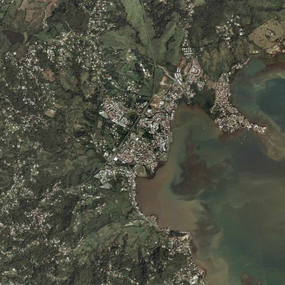
Kaart van Ducos
Interaktiewe kaart
Ducos bevolking
Jaar 1975 tot 2020
| Data | 1975 | 1990 | 2000 | 2015 | 2020 |
|---|---|---|---|---|---|
| Bevolking | 11 593 | 14 080 | 16 166 | 17 780 | 18 409 |
| Bevolkingsdigtheid | 433,4 / km² | 526,4 / km² | 604,3 / km² | 664,7 / km² | 688,2 / km² |
Bronne: JRC (European Commission's Joint Research Centre) werk aan die GHS built-up grid
Ducos bevolkingsverandering van 2000 tot 2015
Toename van 10% van jaar 2000 tot 2015
| Plek | Verandering sedert 1975 | Verandering sedert 1990 | Verandering sedert 2000 |
|---|---|---|---|
| Ducos | +53.4% | +26.3% | +10% |
| Martinique | +20.6% | +11.1% | +2.7% |
Bronne: JRC (European Commission's Joint Research Centre) werk aan die GHS built-up grid
Ducos mediaan ouderdom
Mediaan ouderdom: 38.2 jaar
| Plek | Gemiddelde ouderdom | Mediaan ouderdom (vroulik) | Mediaan ouderdom (manlik) |
|---|---|---|---|
| Ducos | 38.2 yrs | 40 yrs | 36 yrs |
| Martinique | 39.5 yrs | 40.4 yrs | 38.1 yrs |
Bronne: CIESIN (Center for International Earth Science Information Network)
Ducos bevolkingsdigtheid
Bevolkingsdigtheid: 688 / km²
| Plek | Bevolking | gebied | Digtheid |
|---|---|---|---|
| Ducos | 18 409 | 26,8 km² | 688 / km² |
| Martinique | 358 325 | 1 142,9 km² | 314 / km² |
Bronne: JRC (European Commission's Joint Research Centre) werk aan die GHS built-up grid
Ducos historiese en geskatte bevolking
Geskatte bevolking van 1200 tot 2100
Bronne:
- JRC (European Commission's Joint Research Centre) werk aan die GHS built-up grid
- CIESIN (Center for International Earth Science Information Network)
- [skakel] Klein Goldewijk, K., Beusen, A., Doelman, J., and Stehfest, E.: Anthropogenic land use estimates for the Holocene – HYDE 3.2, Earth Syst. Sci. Data, 9, 927–953, https://doi.org/10.5194/essd-9-927-2017, 2017.
Prysverspreiding
Besigheidsverspreiding per prys vir Ducos
Menslike Ontwikkelingsindeks (HDI)
Statistiese saamgestelde indeks van lewensverwagting, opvoeding en per capita-inkomste.
Bron: [skakel] Kummu, M., Taka, M. &Guillaume, J. Roosterglobale datastelle vir Bruto Binnelandse Produk en Menslike Ontwikkelingsindeks oor 1990–2015. Sci Data 5, 180004 (2018) doi:10.1038/sdata.2018.4
Ducos CO2-uitlatings
Koolstofdioksied (CO2) -uitlatings per capita per ton per jaar
| Plek | CO2-emissies | CO2-emissies per capita | CO2-emissiesintensiteit |
|---|---|---|---|
| Ducos | 110,633 tn | 6.01 tn | 4,135.8 tons/km² |
| Martinique | 1,925,583 tn | 5.37 tn | 1,684.9 tons/km² |
Bronne: [skakel] Moran, D., Kanemoto K; Jiborn, M., Wood, R., Többen, J., and Seto, K.C. (2018) Koolstofvoetspore van 13 000 stede. Environmental Research Letters DOI: 10.1088/1748-9326/aac72a
Ducos CO2-uitlatings
| 2013 CO2-uitlatings (tonne/jaar) | 110,633 tn |
| 2013 CO2-uitlatings (tonne/jaar) per capita | 6.01 tn |
| 2013 CO2-uitlatings-intensiteit (tonne/km²/jaar) | 4,135.8 tons/km² |
Natuurlike gevare risiko
Relative risk out of 10
| Gevaar | Risk Level |
|---|---|
| Earthquake | Medium (5.9) |
| Cyclone | Medium (5) |
| Volcano | Medium (5) |
* Risk, particularly concerning flood or landslide, may not be for the entire area.
Bronne:
- Dilley, M., R.S. Chen, U. Deichmann, A.L. Lerner-Lam, M. Arnold, J. Agwe, P. Buys, O. Kjekstad, B. Lyon, and G. Yetman. 2005. Natural Disaster Hotspots: A Global Risk Analysis. Washington, D.C.: World Bank. https://doi.org/10.1596/0-8213-5930-4.
- Center for Hazards and Risk Research - CHRR - Columbia University, Center for International Earth Science Information Network - CIESIN - Columbia University, International Bank for Reconstruction and Development - The World Bank, and United Nations Environment Programme Global Resource Information Database Geneva - UNEP/GRID-Geneva. 2005. Global Cyclone Hazard Frequency and Distribution. Palisades, NY: NASA Socioeconomic Data and Applications Center (SEDAC). https://doi.org/10.7927/H4CZ353K.
- Center for Hazards and Risk Research - CHRR - Columbia University, Center for International Earth Science Information Network - CIESIN - Columbia University. 2005. Global Volcano Hazard Frequency and Distribution. Palisades, NY: NASA Socioeconomic Data and Applications Center (SEDAC). https://doi.org/10.7927/H4BR8Q45.
- Center for Hazards and Risk Research - CHRR - Columbia University, Center for International Earth Science Information Network - CIESIN - Columbia University. 2005. Global Earthquake Hazard Distribution - Peak Ground Acceleration. Palisades, NY: NASA Socioeconomic Data and Applications Center (SEDAC). https://doi.org/10.7927/H4BZ63ZS.
Onlangse aardbewings in die omgewing
Grootte 3.0 en groter
| Datum▼ | Tyd↕ | Magnitude↕ | Distance↕ | diepte↕ | Plek↕ | skakel |
|---|---|---|---|---|---|---|
| 7/24/19 | 5:05 PM | 3.1 | 44.5 km | 33,510 m | 21km NW of Gros Islet, Saint Lucia | usgs.gov |
| 7/27/18 | 1:02 AM | 4.2 | 14.5 km | 157,690 m | 7km SSW of Les Trois-Ilets, Martinique | usgs.gov |
| 12/16/16 | 7:51 PM | 4.3 | 44 km | 166,500 m | 8km NW of Basse-Pointe, Martinique | usgs.gov |
| 11/17/16 | 9:53 AM | 4.5 | 50.5 km | 160,020 m | 15km NW of Basse-Pointe, Martinique | usgs.gov |
| 12/28/15 | 6:55 AM | 5.6 | 41 km | 150,000 m | 20km WSW of Saint-Pierre, Martinique | usgs.gov |
| 3/1/15 | 10:34 AM | 3.2 | 46.7 km | 69,200 m | 32km ENE of Petite Riviere Salee, Martinique | usgs.gov |
| 4/9/14 | 8:50 PM | 4.6 | 49.2 km | 84,350 m | 34km ESE of Le Marin, Martinique | usgs.gov |
| 2/9/14 | 10:54 AM | 4.3 | 36.1 km | 16,800 m | 21km ESE of Le Vauclin, Martinique | usgs.gov |
| 1/19/13 | 9:18 AM | 3.7 | 37.8 km | 75,100 m | Martinique region, Windward Islands | usgs.gov |
| 9/26/12 | 6:15 PM | 4.3 | 42.2 km | 169,600 m | Martinique region, Windward Islands | usgs.gov |


Oor ons data
Die data op hierdie bladsy word geskat met behulp van 'n aantal publiek beskikbare gereedskap en hulpbronne. Dit word verskaf sonder waarborg en kan onakkuraathede bevat. Gebruik op eie risiko.